SDP’s School Profiles, which display District-level data as well as school-level information about SPR scores, climate, and standardized test performance, now have an additional functionality. Thanks to a partnership with the Philadelphia Education Research Consortium (PERC), you may now view expected public transit times to each high school’s physical location from anywhere in the city.
SDP’s redesigned School Profiles now include transit maps for high schools
To begin, visit https://schoolprofiles.philasd.org/ and find a high school by typing its name in the search bar. You can also use the filters in the left-hand toolbar to view a complete list of all high schools.
Once you have selected a school, click “View Transit Time Map” in the blue box in the left-hand column on your screen. (Please note that transit maps, as well as the accompanying full report, are also available from the “Other Info” tab on each high school’s page.)
The key on the right explains how the map is shaded. If you will be traveling from a light yellow area, for example, your public transit commute to this school building should be under 15 minutes. If you are traveling from a red area, it could take 90 minutes.
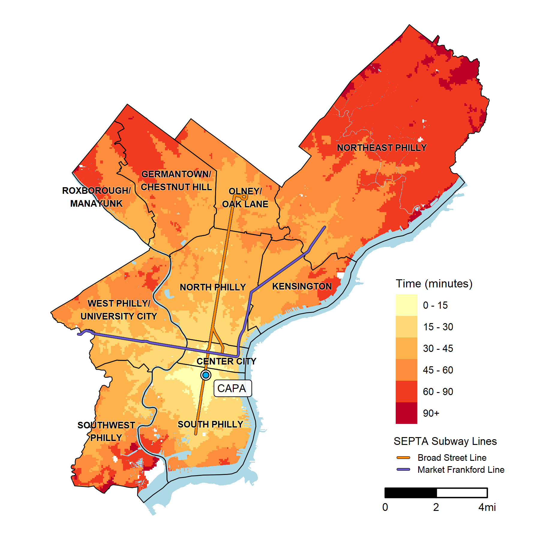
This information may help students and families explore their best options during the school selection process, and could also be valuable to teachers and other staff members. To learn more about the report behind this functionality and its methodology, click here.